At some point in the future, you may find yourself having to explain a lot of Japanese history n a big hurry in order to get to the class you are actually teaching.1 This is a really good book, and also really good if you want to do a lot of visual stuff.
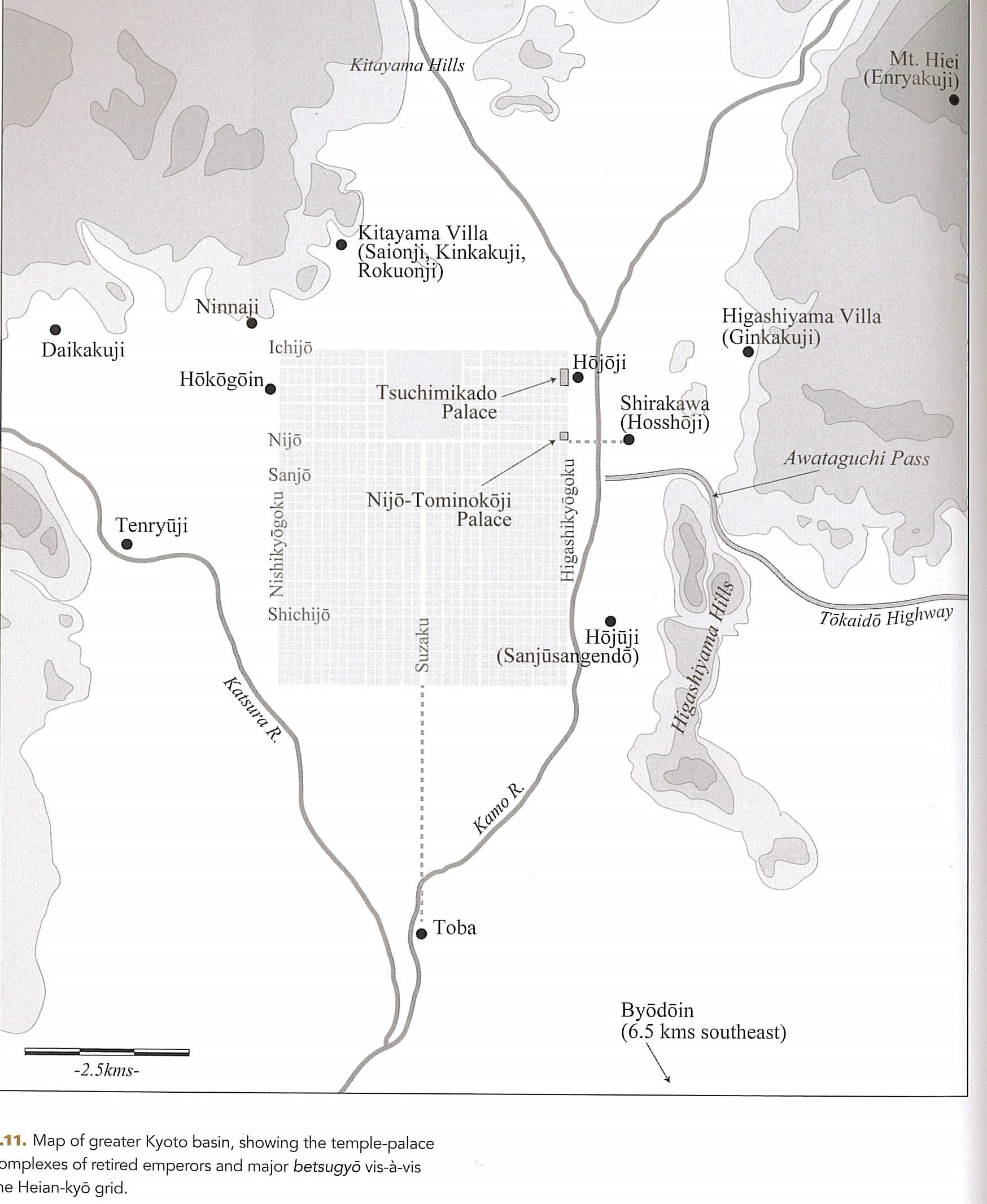
Heian was of course the center of the Chinese-based state model that was established in Japan, and there are lots of pictures for this, but Stavros has a nice one that you can use to explain the orderly “Chinese” pattern that was being established. You can also explain how the Buddhist temples that rulers wanted to keep out located around the capital, along with the residences of the retired emperors.
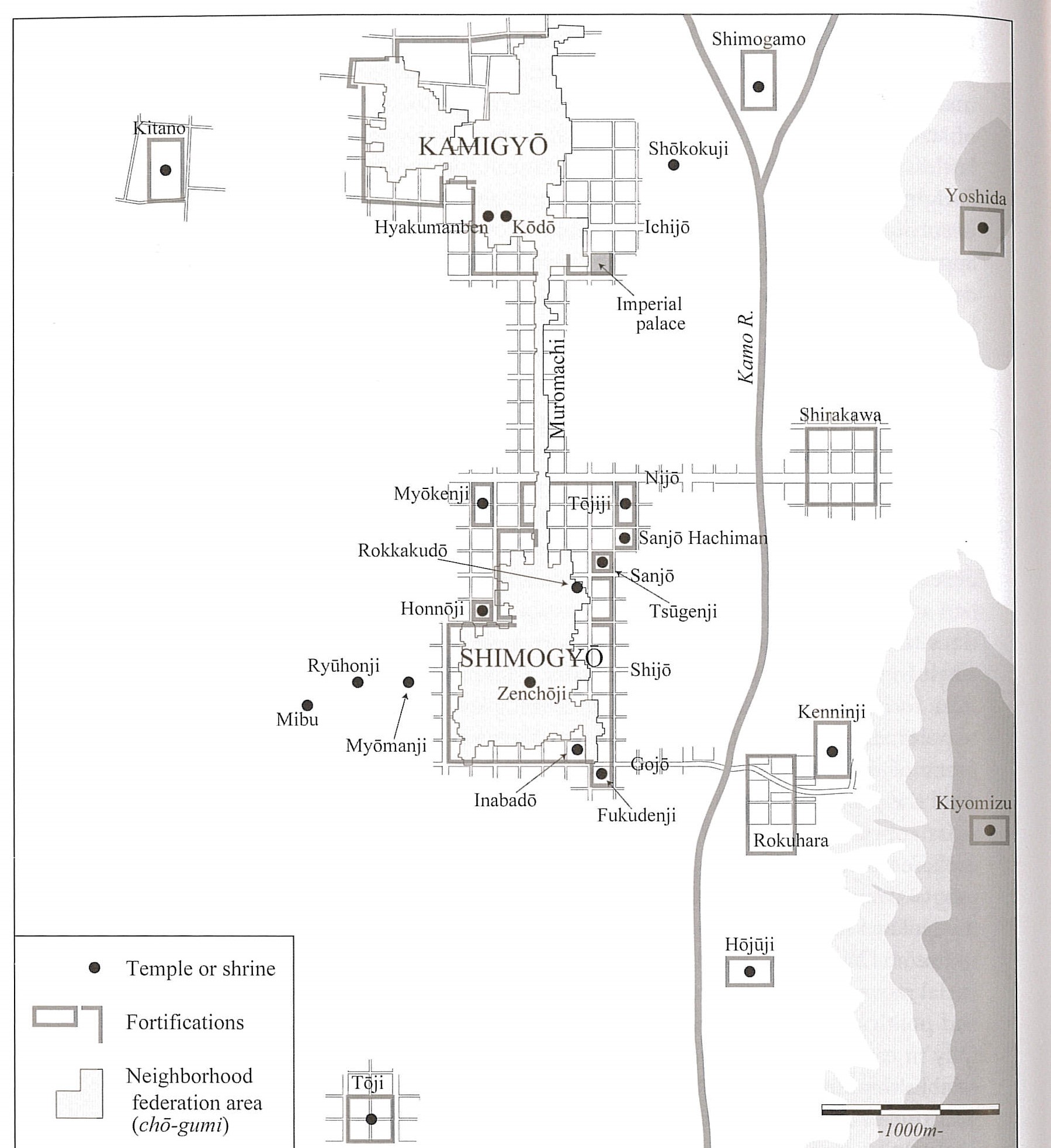
Throughout he talks about the importance of inside and outside, keeping the major temples and the warriors out of the capital. This never worked well, but but you can see signs of in in this map, which shows how the residences of Ashikaga generals were kept on the outskirts.
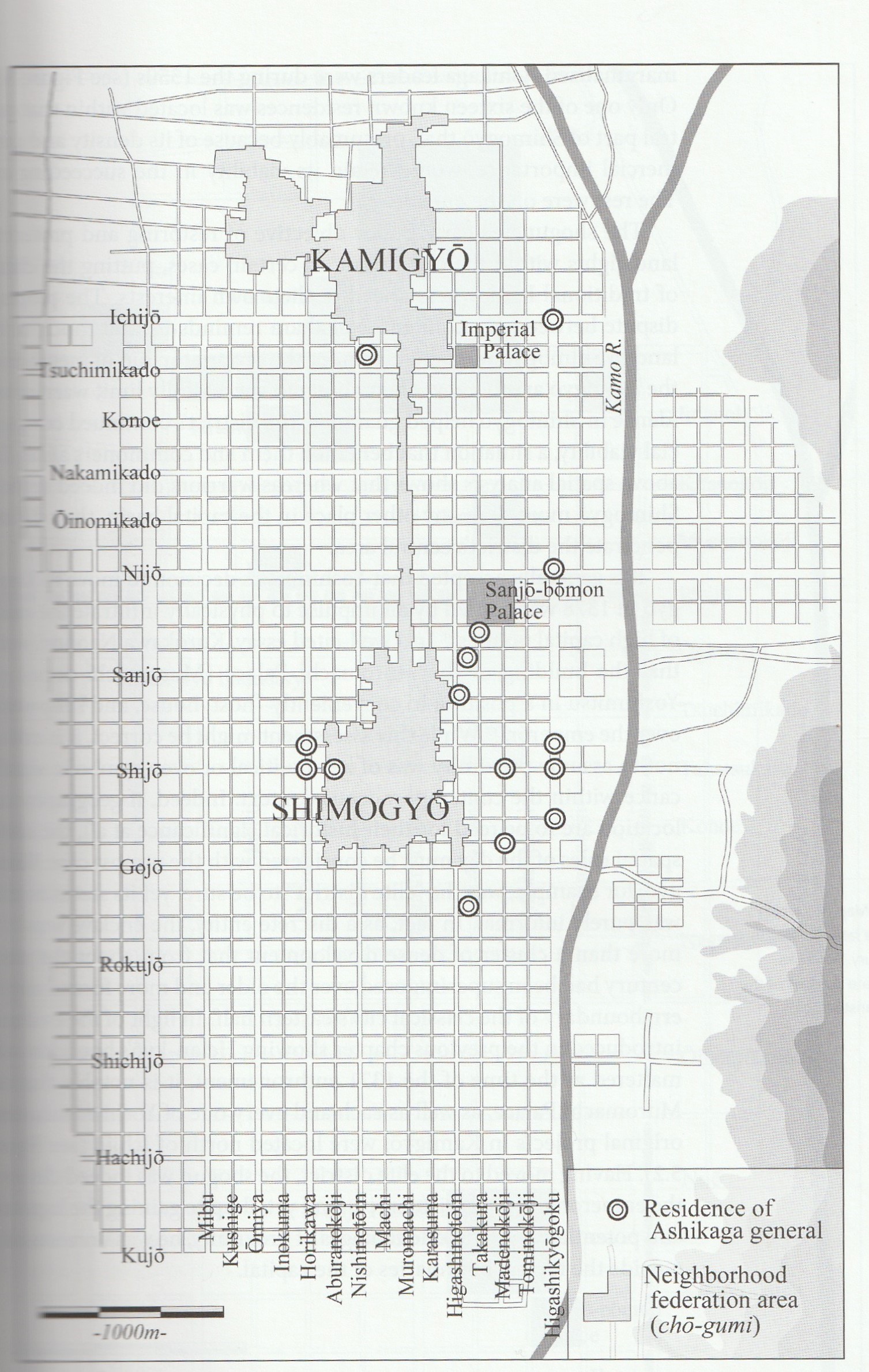
He actually has quite a bit on how the shogun respected the rights of the court far longer than you might expect, from Kamakura bans on horsemanship and archery practice on the site of the old imperial palace (pg. 88) to Ashikaga deference to court ideals and spatial patterns. (Chapter 5)
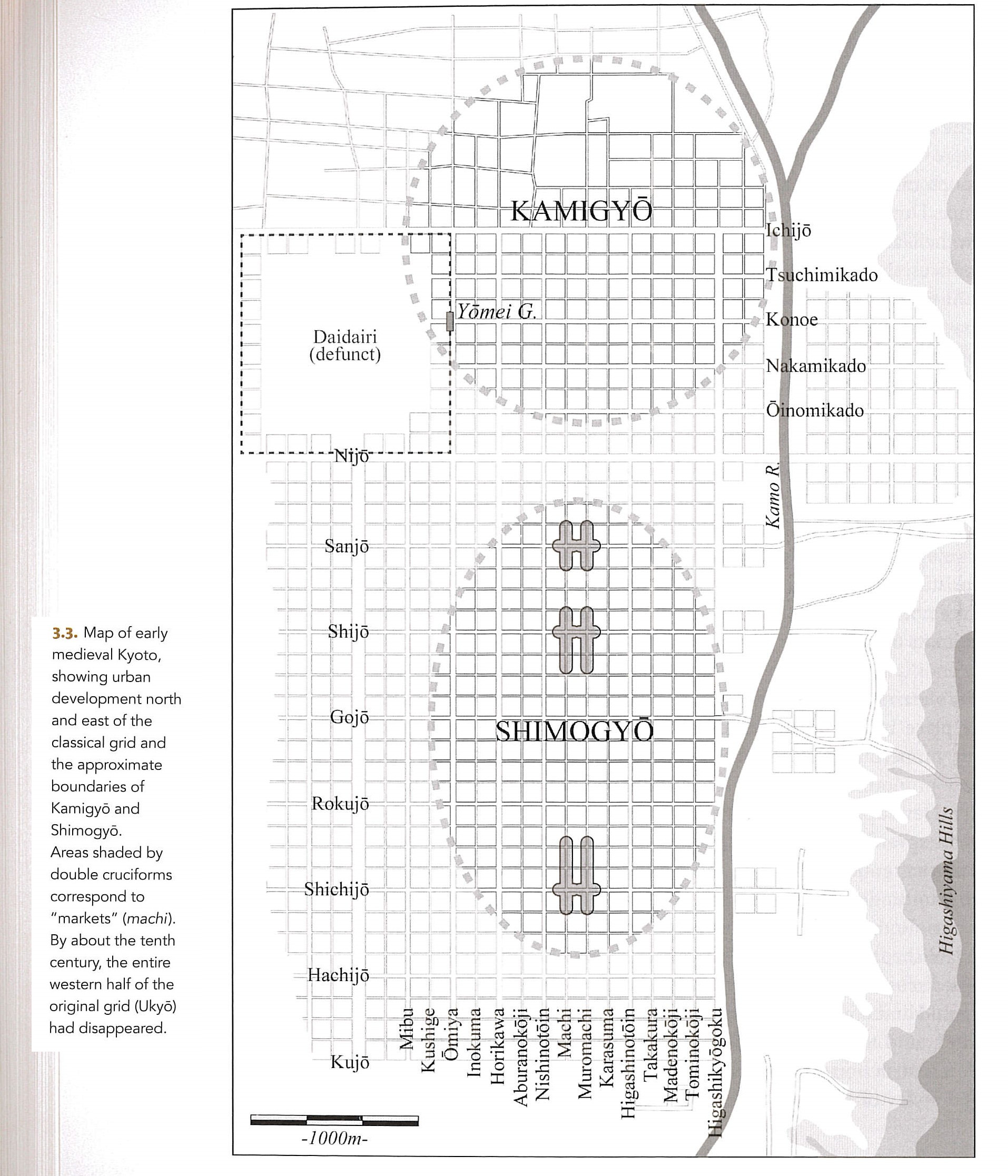
The long decline of the Chinese based system led to the city shifting to the east, with the elite area of Kamigyo in the north, and the more commercial and common area of Shimogyo in the south.
This newly commercialized city was concentrated in the South, which is where the sake brewers and oil sellers were concentrated, as well as the neighborhoods with enough corporate identity to do a float for the Gion Festival.
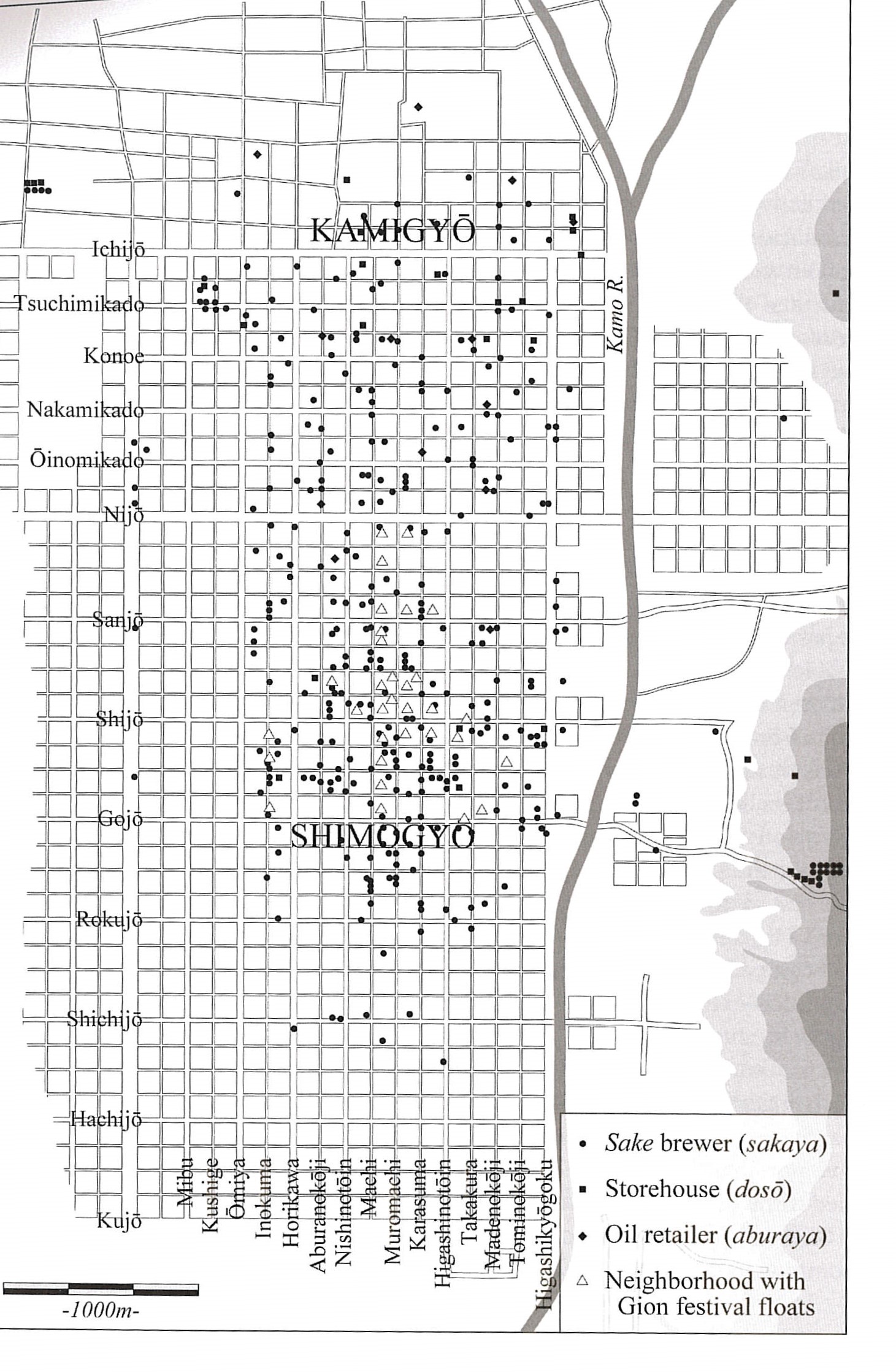
Here is a somewhat more detailed commerce map, along with a map of the brewer-lenders and their shrine affiliations
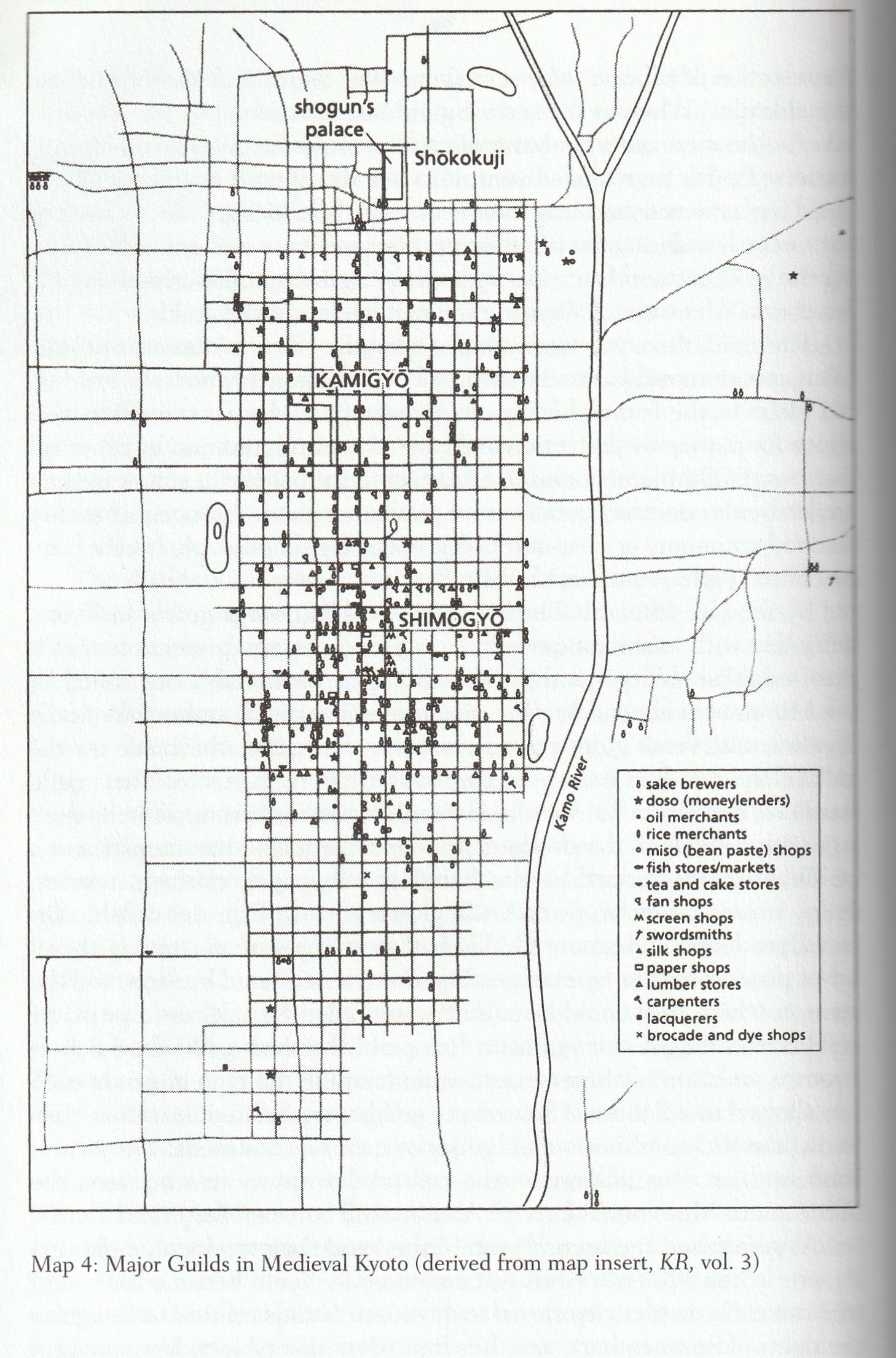
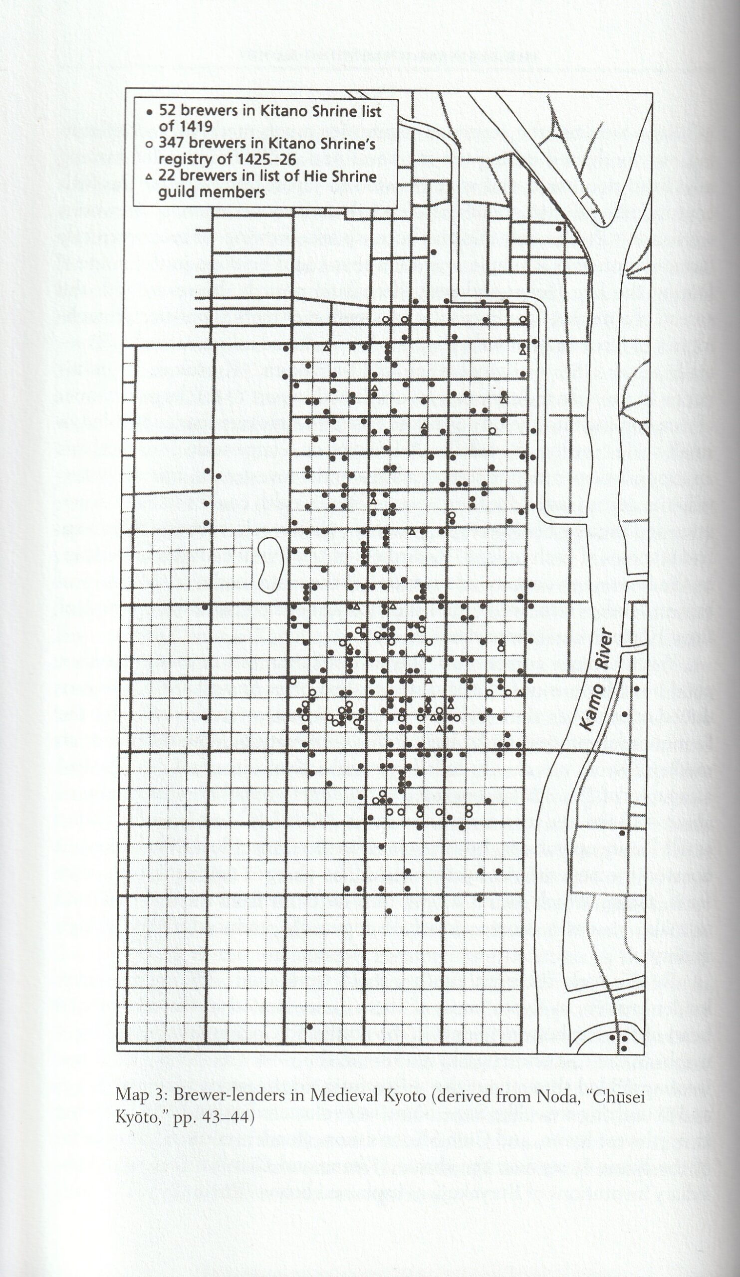
from Suzanne Gay.2 If you want to get into the weeds of urban commerce and money lending she is your scholar.
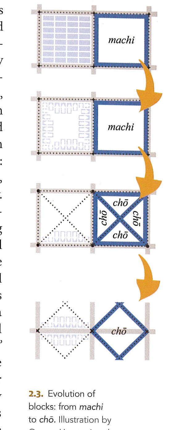
If you want to explain how the wards changed as they went from bureaucratically defined areas to commercial streets, Stavros has both an explanation and a diagram.
Of course you will probably want some quotes on the destruction of the Onin War, and Stavros has you covered.
Holding aged parents in their arms, pulling along wives and children behind them, the townspeople fled the city in a roar of cries. And none was left to fight the blaze. The fires burned over one hundred blocks, from Nijo in the south to Goryo in the north, from Odoneri in the west to Muromachi in the east. About 30,000 residences- of aristocrats, military men, great and small alike-went up in flames. Everything is now ruined.
Across our charred land, all human traces have been extinguished. For blocks on end, birds are the sole sign of life.
Like hornets’ nests, the sanctuaries of the eastern and western hills have all been burned and crushed.
The Capital of Flowers of myriad ages is now a lair of foxes and wolves.
It’s too bad that Night Attack on the Sanjo Palace is too early for this, but I suppose you could use it 🙂
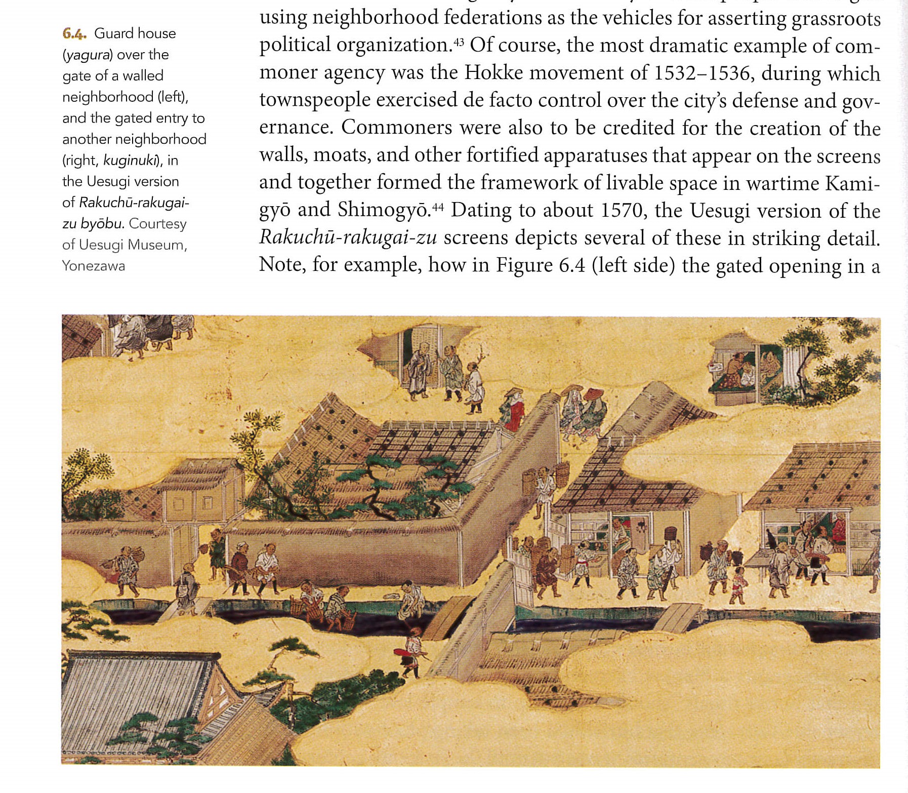
Stavros has both a nice map of the walled districts of what was left of the post-Onin city
and illustrations of the walls and guardhouses
So if you want to run through a lot of Japanese history, and do it with images, this is a good book.
I will be doing that this Spring for HIST 436 Early Modern Japan (1500-1800) )
One way to do some of this is to focus on the city that becomes Kyoto, which not only mattered a lot but was where almost all the sources come from. A really good source on this is Matthew Stavros Kyoto: An Urban History of Japan’s Premodern Capital. (Hawaii, 2016 ). ((You could follow this up with Alice Y. Tseng Modern Kyoto ↩
Gay, Suzanne Marie. The Money Lenders of Medieval Kyoto University of Hawaii Press, 2001. pg. 42, 60 ↩