This page, on the history of Burma and Myanmar (since 1989) is part of a collection assembling links to historical primary sources that are open on the web. It should be seen as a work in progress, and corrections or suggestions for additions are most welcome. These pages were primarily created for the convenience of students who depend heavily on English language sources and may have limited access to large research libraries or commercial databases. Most of the materials below focus on the colonial period sources up to independence in 1948 or various travel accounts published prior to British colonial rule that available online in digital form.
Contents
- Pre-Colonial Burmese Sources in Translation
- Colonial Period Burma Government Reports
- Colonial Period Legal History Sources
- Colonial Period Burma Gazetteers
- Colonial Census Records
- SOAS Burma/Myanmar Collection
- Other Online Collections Related to Burma
- Maps of Burma/Myanmar
- List of Books and Sources Available Online Related to Burma / Myanmar
Pre-Colonial Burmese Sources in Translation
- Duroiselle, Chas, ed. A List of Inscriptions Found in Burma, Part I, 1921.
- Tin, Maung, and G. H. Luce trans. Glass Palace Chronicle of the Kings of Burma, 1923.
- Than Tun, trans. The Royal Orders of Burma 1598-1885, 1983.
- Taw Sein Ko and Tun Nyein, trans. Inscriptions of Pagan, Pinya & Ava, 1899.
- King Wagaru’s Manu Dhammasattham: Text, Translation, and Notes, 1892..
- D. Richardson trans. The Damathat, or the Laws of Menoo, 1847.
Burma Government Reports and Manuals (most of these and many thousands more should be easy to find at the Indian Culture Repository)
- Reports on Lock-Hospitals [hospital-prisons to register, diagnose, and imprison prostitutes under the Contagious Diseases Acts] in British Burma 1873-1886. [CD Acts ended on the home islands in 1886, but they continued in the colonies until 1888, although 1886 is the final year reported on in this digital collection]
-
Mental Health: Reports on the Rangoon Lunatic Asylum 1878-1906 | Notes on the Lunatic Asylums in Burma 1907-1924 | Notes on the Mental Hospitals in Burma 1925-1940
– Annual Report on the Civil Veterinary Department, Burma 1910-1941
- Notes and Statistics on Vaccination in Burma 1889-1933
-
Report on the Indian Hemp Drugs Commission 1894-1895 [This was a major report that would influence government policy, although numerous historians use it as an exploration of the colonial gaze on many areas of life]. Additionally there is an earlier 1893 Report on Ganja in India and the 1895 Resolution in response to the Commission.
-
Reports on the Working of the Harcourt Butler Institute of Public Health 1927-1940
-
Burma Government Medical School Reports 1907-1941
-
Education reports (primary reports followed by [secondary reports]): 1864 budget [aid grant to private schools] | 1865 extension of education [systemic plan; appointment of Public Imitation Director; plan for extension] | 1865 report [measures for promoting education] | 1866 report | 1868 [application for a Karen Female Institution at Toungoo] | 1869 vernacular schools report | 1872 report on public instruction | 1873 report [establishment of Rangoon High School] | 1876 report | 1879 report [pension and leave rights for masters in Middle Class School] | 1881 report | 1883 [education of European and Eurasian children] | 1885 report [incorporation of the British Burma educational syndicate] | 1890 [scheme for reform of Normal Schools] | 1892 [payment to travelling teachers] | 1895 [“Question of Revising the Readers in Use in Burma With a View to Infusing Into Them a Higher Moral Tone“] | 1899 [Recognition of the Educational Officers in Burma Who Were Appointed bythe Secretary of State As Members of the Indian Educational Service] | 1904 [Courses and Textbooks reform]|
-
Burma Foreign Affairs reports: 1891-92 |
-
Burma Research Society Volumes: 1911 | 1912 | 1913 | 1914 | 1915 | 1916 | 1917 | 1918 | 1919 | 1920 | 1921 | 1922 | 1923 | 1924 | 1926 | 1927 | 1928 | 1929 | 1930 | 1931 | 1932 |
-
Shan Hills [multiple instances of these sources exist on this site]: Example of Leader Succession Reports | Example of Tribute Reports | Example of Foreign Relations Reports Regarding Siamese Shan | Example of Military Operation Reports | Example of Law Amendments | Example of Foreign Relations in Regards to Chinese Shan |
-
Reports on the Administration of British Burma 1863-1936 [Myanmar Law Library, might not work if you download too many, the following are alternatives found on IA] | 1867-68 | 1873-74 | 1874-75 | 1875-76 | 1876-77 | 1877-78 | 1878-79 | 1879-80 | 1880-81 | 1881-82 | 1882-83 | 1883-84 | 1884-85 | 1885-86 Lower Burma 1886 Upper Burma | 1885-86 Lower Burma | 1889-90 | 1891-92 | 1892-93 | 1893-94 | 1894-95 | 1895-96 | 1896-97 | 1897-98 | 1898-99 | 1924-25 | 1925-26 | 1928-29 | 1929-30 | 1930-31 | 1931-32 | 1932-33 | 1933-34 | 1934-35 | 1935-36
-
Report on the Administration of the Stamp Revenue 1917
- Report on the Land Revenue Administration of Burma 1909 | 1912 | 1913 | 1916 | 1918 | 1919 | 1921
- Report on the Revenue Administration of Burma, for the year | 1869-70 | 1872-73 | 1890-91 | 1892-93 | 1893-94 | 1894-95 | 1896-97 | 1898-99 | 1899-1900 | 1900-01 | 1901-02 | 1908-09 | 1909-10 | 1911-12 | 1912-13 | 1915-16 | 1917-18 | 1918-19 | 1920-21
- Report on the Public Health Administration of Burma 1923 | 1924 | 1925 | 1926 | 1927 | 1928 | 1929 | 1930 | 1931 | 1932 | 1933 | 1934 | 1935 | 1936
- Report on the Police Administration of Burma 1899 | 1900 | 1901 | 1902 | 1903 | 1916 | 1918 | 1920
-
Local Government Circulars issued from the General Secretariat. 1888 to the 31st March 1915 Vol I (Chronological Index) | Vol II. 1888 to the 31st March 1928 Vol I (Chronological Index) | Vol II? [only physical copies found]
-
Reports on Settlement: 1879-80 | 1880-81 | 1885-86 | 1886-87 |
- Report on the Revision Settlement Operations: Myaungmya and Thongwa District 1902-1903 | Myaungmya District 1916-19 | Pyapôn District 1906-07 | Tharrawaddy District 1900-1901, 1901-1902 | Thaton District 1907-8
- Report on the Settlement Operations being Original Settlement in the Sinbaungwe Township and in parts of the Minhla, Thayetmyo and Allanmyo Townships and Revision Settlement in Parts of the Thayetmyo, Allanmyo and Mindon Townships of the Thayetmyo District 1913-16
- Report of the Village Administration Committee 1941
- British Military Administration Burma Annual Report 1944
- Report Of The State Of Public Health In Burma 1947
- The Burma Subdivisional And Township Office Manual, 1910
- Report on Archaeological Work in Burma 1901-1902 | 1902-1903 | 1903-1904 | 1904-1905
- Report on the Trade and Navigation of Burma 1885-1886 | 1897-1898
- Annual Sanitary Report for Rangoon 1921
- Report on the Working of the Rangoon Municipality [physical copies covering Rangoon’s entire colonial history in British Library and Cambridge University Library] 1894-1895 | 1895-1896 | 1896-1897 | 1897-1898 | 1898-1899 | 1899-1900 | 1900-1901 | 1901-1902 | 1902-1903 | 1903-1904 | 1904-1905? | 1905-1906 | 1906-1907 | 1907-1908 | 1908-1909? | 1909-1910 | 1918-1919 | 1920-1921
- Report Of The Burma Provincial Banking Enquiry Committee, 1929-30 Vol 1 | Vol 2 | Vol 3
- The Upper Burma Headman’s Manual, 1912
- Burma Village Manual, 1926
- Burma Police Manual, Vol 1 5th edition, 1939 | Vol 2 5th edition, 1940 | Vol 4 5th edition, 1953.
- Burma Provincial Estimates 1928-29
The Myanmar Law Library offers an extensive online and open access collection of PDF downloads of documents related to the legal history of Burma dating back to the colonial period. Some of these are very heavy files: if you are downloading many of these, consider doing so from the Internet Archive to reduce the burden on the law library, when they are marked as available there. Some of their sources include:
- Burma Law Times Contents Page | Vol 1 1907 | Vol 2 1909 | Vol 3 1910 | Vol 4 1911 | Vol 5 1912 | Vol 6 1913 | Vol 7 1914 | Vol 8 1915 | Vol 9 1916 | Vol 10 1917 | Vol 11 1918 | Vol 12 1919 | Vol 13 1920
- Burma Law Journal Contents Page | 1922 | 1923 | 1924 | 1925 | 1926
- Lower Burma Rulings 1900-1922 [MLL] (IA) Selected Judgements of Lower Burma 1872-1892 | Printed Judgements of Lower Burma 1893-1900 | 1900-1902 | 1903-1904 | 1905-1906 | 1907-1908 | 1909-1910 | 1911-1912 | 1913-1914 | 1915-1916 (use archive) | 1917-1918 | 1919-1920 | 1921-1922
- Upper Burma Rulings 1892-1922 [MLL] (IA) 1892-1896 Criminal | 1892-1896 Civil | 1897-1901 Criminal | 1897-1901 Civil | 1902-1903 Criminal | 1902-1903 Civil | 1904-1906 Criminal | 1904-1906 Civil | 1907-1909 Civil | 1907-1909 Criminal | 1910-1913 Vol 1 | 1914-1916 Vol 2 | 1917-1920 Vol 3 | 1921-1922 Vol 4 | Index 1892-1917 | Index
- Indian Law Reports Rangoon Series (IA) Contents Page | 1923 | 1924 | 1925 | 1926 | 1927 | 1928 | 1929 | 1930 | 1931 | 1932 | 1933 | 1934 | 1935 | 1936-1937
- Rangoon Law Reports (IA) Contents Page | 1937 | 1938 | 1939 | 1940 | 1941 | 1942 | 1946 | 1947
- Burma Law Reports 1948-1988 – Many of these are in English. The Myanmar Law Reports 1989- are in Burmese.
- All India Reporter, Rangoon Contents Page | 1925 | 1929 | 1930 | 1934
- Burma Acts (English) 1946-1962
- Laws and Regulations of British Burma
- Constitutions
- Many more sources available in Burmese
-
Appeal Cases, | 1870 |
Other legal sources:
- Burma Code
- Constitutions (1935, 1943, 1947)
- Laws (1824-1942, 1945-1948)
- Case Law (Lower Burma 1872-1922, Upper Burma 1892-1922, Rangoon 1923-1947, Burma Law Times 1907-1920, Burma Law Journal 1922-1927)
- The Burma Gazetteer in Two Volumes (1879-1880). Vol 1, Vol 2.
- Gazetteer of Upper Burma and the Shan States (1900-1901)
Part I: Vol I | Vol II. Part II: Vol I | Vol II | Vol III - Imperial Gazetteer Of India Provincial Series Burma (1908). Vol 1 | Vol 2
- Gazetteer to Maps of Burma 1944 (with locations referring to Survey of India Burma Sheets plus Lat/Long)
Burma Gazetteer District Volumes
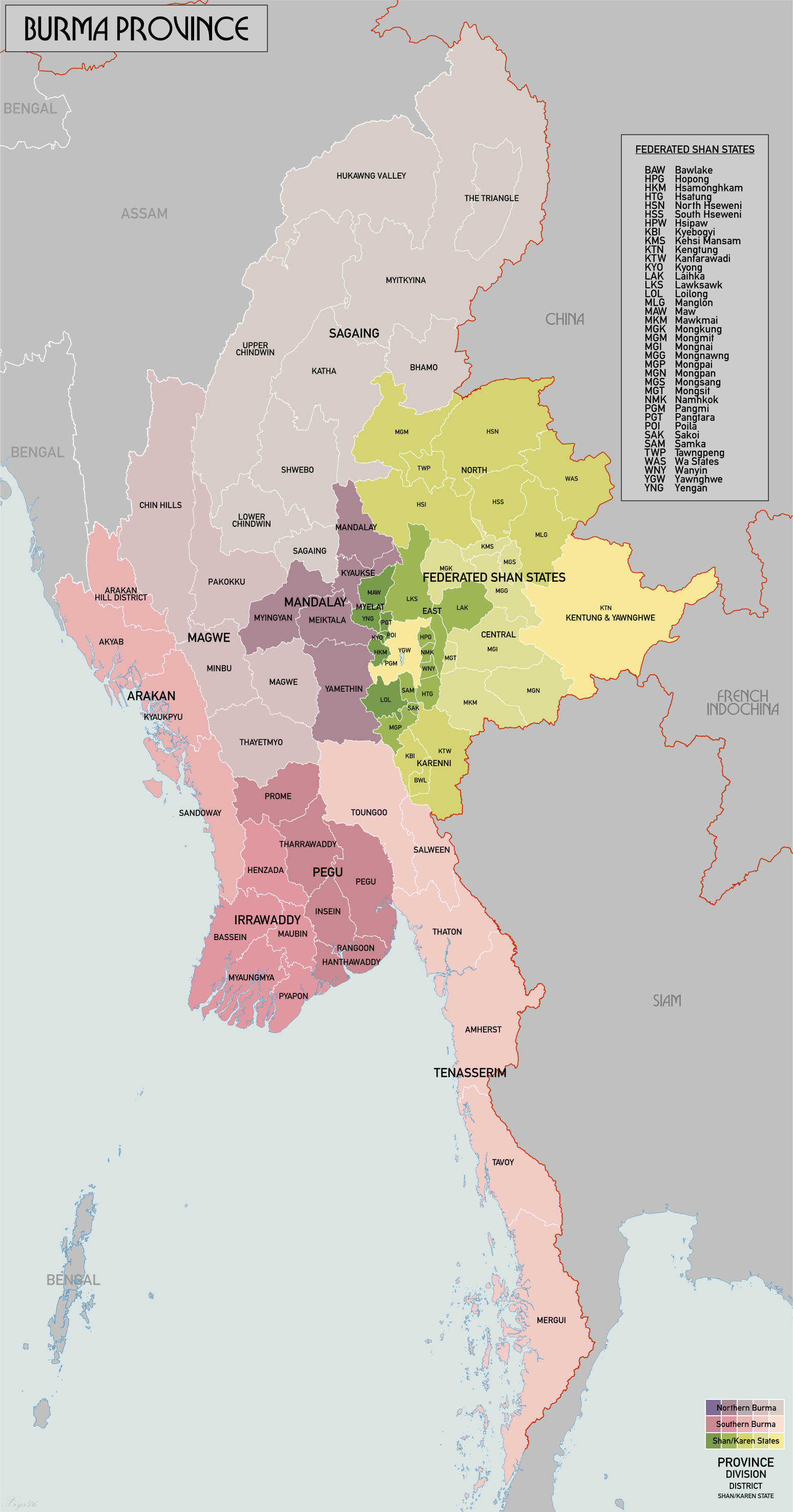
For the following volumes, you may wish to refer to this Wikimedia map based on 1931 colonial period districts:
- Arakan Hills Vol A 1910 | Vol B 1912 | Vol B No 2 1924
- Akyab Vol A 1917 | Vol B No 1 1912 | Vol B No 1 1924
- Amherst Vol A 1913 | Vol B No 19 1913
- Bassein Vol A 1916 | Vol B No 11 1912
- Bhamo Vol A 1912 | Vol B No 27 1913 | Vol B No 28 1925
- Lower Chindwin 1912, Vol B No 33 1913 | Vol B No 34 1925
- Upper Chindwin Vol A 1913 | Vol B No 34 1913 | Vol B No 35 1925
- Hanthawaddy (Syriam) Vol B No 7 1913 | Vol B No 7 1924
- Henzada Vol A 1915 | Vol B No 12 1924
- Insein Vol A 1914 | Vol B No 6 1913 | Vol B No 6 1924
- Katha Vol B No 29 1913 | Vol B No 30 1925
- Kyaukpyu Vol B No 3 1924
- Kyauksè Vol A 1925 | Vol B No 35 1913 | Vol B No 37 1925
- Ma-ubin Vol A 1931 | Vol B No 14 1924
- Magwe Vol B No 25 1913
- Mandalay Vol A 1928 | Vol B No 26 1913 | Vol B No 27 1925
- Meiktila Vol B No 36 1913 | Vol B No 38 1924
- Mergui Vol A 1912 | Vol B No 21 1913
- Minbu Vol B No 24 1913
- Myaungmya Vol B No 13 1912 | Vol B No 13 1924
- Myingyan Vol B No 38 1913 | Vol B No 40 1924
- Myitkyina Vol A 1912 | Vol B No 28 1913 Vol B No 29, No 31 1925 (with Putao District)
- Pakokku Vol A 1913 | Vol B No 23 1913
- Pegu Vol A 1917 | Vol B No 9 1913
- Putao Vol B No 31 1925 (with Myitkyina)
- Prome Vol B No 10 1913
- Pyapôn Vol B No 15 1912 | Vol B No 15 1924
- Rangoon 1868
- Ruby Mines Vol A 1915 | Vol B No 30 1913 (with the Mong Mit State)
- Sagaing Vol B No 32 1913 | Vol B No 33 1925
- Salween Vol A 1910 | Vol B No 17 1913
- Sandoway Vol A 1912 | Vol B No 4 1912 | Vol B No 4 1924
- Shwebo Vol A 1929 | Vol B No 31 1913
- Syriam Vol A 1914
- Tavoy Vol B No 20 1913 | Vol B No 20 1924
- Tharrawaddy Vol A 1920 | Vol B No 8 1912 | Vol B No 8 1924
- Thatôn Vol A 1931 | Vol B No 18 1913 | Vol B No 18 1924
- Thayetmyo Vol A 1911 | Vol B No 22 1913
- Toungoo Vol A 1914 | Vol B No 16 1913
- Yamèthin Vol A 1934 | Vol B No 37 1913 | Vol B No 39 1924
-
Southern India with Tenasserim & Singapore 1855
See Burma Library Census section for some entries.
1872 – Report On The Census Of British Burma Taken In August 1872
1881 – Report of the Census of British Burma Taken on the 17th February 1881
1891
- Government of India Census of 1891 Imperial Tables Burma Report Vol. 2, 1892.
- Government of India Census of 1891 Provincial Tables Burma Report Vol. 3 District, Township, Circle, and Village Tables of Lower Burma, 1892.
- Government of India Census of 1891 Provincial Tables Burma Report Vol. 4 District, Township, Circle, and Village Tables of Upper Burma, 1892.
- Census of India, 1891, Vol. II- Imperial Tables, Imperial Series Burma Report, IX and X, 1892.
1901
- Census of India 1901 Vol. 12 Burma Part I. Report.
- Census of India 1901 Vol. 12a Burma Part II. Imperial Tables.
- Census of India 1901 Vol. 12b Burma Part III. Provincial Tables. Lower Burma.
- Census of India 1901 Vol. 12c Burma Part IV. Provincial Tables. Upper Burma, The Shan States, and the Chin Hills.
1911
1921
1931
- Burma News 1897-1970 – Quarterly Paper of the Rangoon Diocesan Association. SOAS has digitized a large number of the issues of this pamphlet and annual reports for the organiztion.
- G. H. Luce Papers – Over a dozen notebooks, including notes in other languages, of the colonial scholar Gordon H. Luce have been digitized and are hosted at SOAS. More on him through the Luce Collection at the National Library of Australia.
- Burma/Myanmar Collection Items – See there list of over a hundred digital materials related to Burma/Myanmar.
- SOAS Bulletin of Burma Research – Bibliography of secondary literature (Archived) – This 2004 bibliography has over two hundred pages of sources related to Burma.
- SOAS Bulletin of Burma Research – Issues from this journal from 2003-2008 are online. Examples of reviewed primary sources include: | Account of the Journey of Hieronimo di Santo Stefano, a Genovese, 1495-1496 | Certaine Words of Pegu Language, 1603 | Account of Pegu and the Voyage to Cambodia and Siam, 1718 | Diary of the Proceedings of an Embassy to Burma, 1760 | A Voyage to Pegu, 1770s | Concise Account of the Kingdom of Pegu, 1785 | Many more of these translated or edited sources from the SOAS Bulletin of Burma Research can be found on Core which provides the metadata for millions of articles.
Other Online Collections Related to Burma (Items in bold are the most reccomended)
- Hathi Trust is probably the best for finding unique material that will not appear in other collections.
-
For ideas of additional sources, see this Selected Reference List by Cecil Hobbs, 17 pages worth of British White Papers considered important to understanding Myanmar.
-
Southeast Asia Visions – This digital collection at Cornel University includes hundreds of digitized books related to Southeast Asia. Many, but by no means all, of the books related to Burma are listed below and it is well worth exploring their collection.
- Burmese Album – This collection of photographs is hosted by Colgate University. “An album of sepia albumen photographs taken in Burma by the expatriate German photographer Philip Adolphe Klier.” Read more about this collection here.
- Burma and British India album, circa 1900s – A collection of photographs from an album made available by The Wolfsonian – Florida International University [photos are untitled on the download list]. The Wolfsonian has a number of maps, photos, and objects from Burma digitalised.
- Burma Library – “Classified and annotated links to more than 60,000 full text documents on Burma/Myanmar”. See for example the history subsection.
- The Anglo-Burmese Library – This organization, which requires membership for access to its member-only collection of documents, preserves records of families in colonial-era Burma and maintaining a list of 1942 evacuation and casualties. The library has a non-member area with a limited number of materials.
- Digital Bodleian – The Boldeian library at Oxford, has several digitized materials related to Burma.
- Pathé Films – This archive of film clips has several dozen clips from Burma, including curated lists (mostly from the Second World War) such as: Burma | War in Burma | 1943, Burma | Back from Burma
- Digital South Asia Library – This collection, based at the University of Chicago is especially useful for the period when Burma was treated by the British as part of its administration of India, up to 1937.
- Medical History of British India – This National Library of Scotland collection includes the Annual reports on the working of the Harcourt Butler Institute of Public Health, Rangoon 1927-1940. It also has reports related to Vaccination in Burma 1889-1933. See more on the catalogue entry for the institute reports, and the entry for the vaccination reports. It may take a deeper dive to uncover the mentions of Burma in various reports surveying the whole of British India, such as the reports of various diseases which would uncover some interesting tidbits. There is also an excellent selection of secondary sources on South Asian colonial medical history on this webpage. For a quick view of how medical issues were mapped, graphed, and photographed, you can also narrow the search for resources on this site to just images, of which there are thousands. This slightly more obscure search mechanic can be used to pinpoint every mention of Burma the cataloguers have found on specific pages in general surveys, though this is not totally exhaustive of mentions of Burma.
- Wellcome Trust Archives – The Wellcome trust has over five under digital items related to Burma, including copies of some of the vaccination reports available in the NLS above.
- British Library Digital Collections related to Burma – Use the “Available Online” feature of the catalogue to identify online materials in the British Library. There are, for example, hundreds of images from Rangoon/Yangon and broader Burma. See also the extensive collection of photographs made available on Flickr by the British Library. Other search locations include the Library’s Digitised Manuscripts.
- Burma during Special Plague Duty – An album of over forty photographs. “(George) Harley Newcombe was on Special Plague Duty in Burma in 1906, This album is marked “Wishing you very many happy returns of THE DAY Sept 23 1906 Harley”
- Deutsche Digitale Bibliothek – This library has an extensive collection of materials related to Burma including digital versions of many documents not easily found online elsewhere but see also their photos related to burma as well as several thousand Burma tagged objects in general.
- British Museum – There are many images of items relating to burma in the British Musem’s digital collections. The upcoming exhibition, “Burma to Myanmar: 1500 Years of Connection and Isolation” running 2nd November 2023-11th February 2024, has resulted in many more resources becoming digitised.
- Photographs taken by my greatgrandfather in Burma circa 1920 – A collection of photographs by P Mashall who worked for the Bombay Burma Trading Corporation in the teak lumber industry.
- UK National Archives Flickr Photographs – Over one hundred photos related to Burma from the UK National Archives.
- Chronology of the Press in Burma (Archived) – The Irrawaddy has a nice timeline history of the press in Burma. So far, I have not found a digital archive for any of the colonial period newspapers.
- Burma/Myanmar Bibliographic Project – This extensive bibliography, edited by Siegfried M. Schwertner includes a huge range of primary and secondary sources in West-European languages.
-
Researching Colonial Burma on the Internet – The historian of colonial Burma Jonathan Saha wrote up a post on his Colonizing Animals blog with lots of tips on finding information about Burmese history online. Many of these links have been added here. See also his many posts on Burmese history for engagement with primary sources in both English and Burmese language.
-
Pictures of Burma, Mandalay, and Rangoon from c.1907, there are hundreds of images here.
-
Major Arthur Moon’s collection, he provided some of the most detailed descriptions of a Second World War POW camp in Burma including drawings and maps (including of the Bridge over the River Kwai).
-
The Government of India’s Indian Culture Repository, possibly even better than Internet Archive for open access sources on South Asia.
-
The CIA’s Freedom of Information Act Reading Room also has numerous documents on Communist/Chinese/Soviet/American activities in Burma, including many from the Second World War such as intelligence reports on intercepted Japanese messages as well as evaluations on the general situation in Burma.
-
South Asia Commons has numerous sources on Burma, however you may need to start a free trial to access their sources if you lack an affiliated university. In this case, prepare which sources you want to look at in advance and then power through them to make the most of any free trial.
-
Trove has sources from Australian newspapers, magazines and newsletters, maps, images and artefacts, reports, books and articles, diaries and letters, and music and videos.
-
State Library of New South Wales, like other Australian libraries, has a number of resources on the Second World War in Burma as well as accounts of other Anzac voyages through Burmese ports on the way to Europe. Digital manuscripts search is here.
-
Kyoto University Library Network has fantastic sources linked to multiple Japanese universities. Particularly useful if searching for Japanese language sources.
-
Gale offers a huge array of primary sources. In particular, the Nineteenth Century Online Collection has plenty to work with. Be warned, when accessing too many sources in a row through institutional access the authentification shiboleth might break. You will not have access to many documents, so either search for relevant documents in other open-access archives or maybe try a free trial.
-
Rory Stewart’s Turquoise Mountain Foundation revives and preserves several major architectural and fabric materials in Myanmar. It may be useful to see what restoration projects are ongoing in Yangon’s streets.
- Perry-Castañeda Library Burma (Myanmar) Maps – An excellent collection of historical maps related to Burma.
- Old Maps Online
- David Rumsey Map Collection – Many of these are linked from Old Maps Online above but sometimes easier to find through the David Rumsey home page.
G. H. Luce’s collection features over 100 maps of his studies on SE Asia, from ancient history to his own time.
Aeronautical charts from Australian National Airways show postal routes from Australia, across significant airports in Asia (including Rangoon), and to Europe.
Nestlé’s Pictorial World Atlas, 1939, shows administrative maps of the world with illustrations of daily life and monuments (Burma, pages 7-9).
Maps of Rangoon & Other Cities: | Plan of Rangoon and the Vicinity 1827 | Island of Cheduba [1840?] | Sketch Plan of Rangoon 1853 | Mandalay & Environs, 1894 | Late 1910s | Map of Water Availability from New Tube Wells, 1929 | Japanese Notes over English Map, 1930s | Two Part Map (including Insein), 1944 [click “up a level” or “down a level” to see all maps in collection] |
Burma (& Occasionally the Surrounding Region): | Ptolemey’s Bay of Bengal | Magni Mogolis Imperium, [1658?] | Magni Mogolis Imperium de Novo Correctus et Divisum, [1710?] | South & SE Asia, 1770 | Coast of Pegu, 1778 | Coast of Tanasserim, 1778 | East Indies, 1789 | Map of Settlements and Trade of the Irrawaddy up to Ummerapoora, 1795 | Aaron Arrowsmith’s Map of Shipping Routes in the East Indies, 1800 | East Indies, 1808 | Chart of the East Indies, 1814 [Check Malay World Sources Page to Find Numerous Maps of this Region Including Burma] | French Map of South & SE Asia, 1821 | French Map of Burma, 1825 | Burma & China by the Society for the Diffusion of Useful Knowledge, 1829 | John Arrowsmith’s Map of SE Asia, 1834 | Countries Between Turkey & Burma, 1839 | China & Burma, c.1848 | With South China Sea & Indonesia, 1848 | John Rapkin’s Map of Burma & China with Illustrations, 1851 | South, SE, & East Asia, 1852-1885 | SE Asia, 1853[?] | East Asia in Pictorial Book, 1853 | Political Borders, 1853 | Cosmological Map of Mandalay, c.1857-c.1885 | Burma & SE Asia, 1858[?] | One of Richard Sprye’s Proposals for Routes to China with Relation to French Conquests, 1860s | Routes from Rangoon, Through Shan, to China, 1865 | Railway Communications with Western China Commissioned by the House of Commons, 1865 | Survey of Routes from Rangoon to China, 1867 | Very Rough Sketches of Northern Burma, [1868?] | SE Asia, 1872 | Comparison of Sprye’s Overland Route to Shan & China to Sea & French Routes, 1873 | Pegu Topographical Survey, 1875 | Comparison of French and British Overland Routes to China (Burma & Anam), 1878 | Upper Burma, 1880[?] | Robert Gordon’s Map Tracking the Tibetan Tsangpo River’s Course to the Irrawaddy According to Native Authorities, 1885 | SE Asia, 1885 | Robert Gordon’s Maps of Historical River Courses, 1885 | South-Eastern Frontier with Upper Burma, 1886, Updated to 1912 | Siam, 1888 | Burmese Map of the New Hard Borders in Shan, c.1889 | Illustration of the March 1st 1894 Treaty with China | George Morrison’s Route from Shanghai to Rangoon, 1895 | Skeleton Map of 1897 Modifications to the 1894 Border Agreement with China | Northern Burma Borders, 1900s[?] | Route to the Indies, 1900 | Asia Illustrated in Novel, 1902 | 1-Inch Map of Burma, 1907 | China & Japan, 1910[?] | Veterinary and Pony Stations, 1910 [This file includes annual reports of civil veterinary issues containing similar maps of Burma through to the 1920s on various issues, a separate file carries on until the 1930s and another until the 1940s] | Railway & Steamship Routes of the Far East, 1920s | Stanford’s Map of China & Japan including the Surrounding Regions, 1922 [An Earlier Version of this Map Exists here, 1895?] | Vaccination Map, 1926-1927 | China & Japan, 1930s[?] | Racial Map, 1931 | Linguistic Map, 1931 | Australian Motorists Petrol Co. “Be in the Van to Smash Japan” Map of the Pacific, 1940s | Chengmai, 1940s | Japanese Map of Burma, 1940s | Mergui, 1940s | Pegu, 1940s | POW Camps in Asia, 1940s | East Burma and the SE Asian Hinterland, 1941 | Japanese Comparisons of South Asian, SE Asian, & Pacific Territories to Japanese Territories in Size, 1942 Japanese Maps of Burma, 1942 | Japanese World Map, 1942 | Motorists Map, 1942 | Pacific Ocean, 1942 | Burma, 1943 | Distribution of Labour Across the Burma-Siam Railway, 1943 | Thai-Burma Railway, 1943 [and a second map here] | Tamarkan POW camp [and another here] | Burma Road, 1945 | Pegu & Thai Shan, 1945 | Detailed Maps of Burma, 1945 [click “up a level” or “down a level” to see all maps in collection] | Transportation Map of Burma & Western Thailand, 1945 | Burma’s Size Compared to Europe, 1945 | Victory in Burma, 1945 | Army Campaign Route & Battle Area of Second Burma Campaign, 1948 |
Burma with South Asia: | South Asia with Roads, 1768 | Chittagong, 1818 [British Territory Contested by Burma] | Languages Map, 1824-1852[?] | Military Divisions, 1824-1852[?] | Political Borders, 1824-1852[?] | Political Borders (Chiefly Compiled by Native Knowledge), 1824-1852[?] | Resources Map, 1824-1852[?] | Tea Cultivation in Upper Assam & Northern Burma, 1838[?] (f.54r) | India, Burma & the Straits Settlements, 1852-1885[?] | Atlas featuring Tenasserim, 1854 | “Rice Ports of India”, 1872 | Cholera in India, 1875 | SE Frontier with Burma, 1886[-1912] | SE Frontier, 1891 | Leprosy in India, 1891 [there are numerous maps in this document which include Burma] | Atlas of India, 1894 | Distribution of Wild Hemp, 1895 | Plague in India, 1897 | Burma & Assam States, 1897 | Cattle Breeding, 1904-1905 [This file contains numerous other civil veterinary maps of British India from 1893-1911] | Border with Assam, 1910s | Infrastructure Map, 1910 | Infrastructure Map, 1916 | Constitutional Map, 1940s | Infrastructure Map, 1936[?] | Maps of South Asia, 1941 | Topographic Surveys of South Asia, 1869[?]-1947[?] |
Digital Newspapers and Journals
Thousands of articles relating to Rangoon and Burma are digitised on “Trove” (mostly Australian papers). Trove similarly has sources from magazines and newsletters, maps, images and artefacts, reports, books and articles, diaries and letters, and music and videos.
Straits colony newspapers are digitised on “Newspaper SG”, interesting articles on Rangoon/Burma can be found such as the advertisement of Burmese funeral trams in Rangoon or the importation of rickshaws.
Details of newspapers, including their language and the political leanings of their writers, were produced by the government in documents such as this one, as well as ones specific to Burma, other editions of which can be found on Indian Culture.
Music
- On the Road to Mandalay, Rudyard Kipling & Oley Speaks: sheet music |
-
Burmese Xylophone/Pattala, c.1875-c.1925
-
The Burman Lover, 1851
-
Burmah Moon, 1919
-
Karen Hymn Books, 1878
-
2022 Spotify Playlist
-
Khit Haung (Burmese-Colonial fusion music, c.1910s onwards), YouTube
-
Myanmar’s Ministry for Information has taken to collecting traditional Burmese music and transcribing it
-
Pat Waing Drums, used in Hsaing Waings
Local Languages Sources (translations vary from one edition to another and there are included notes by each edition’s translator)
- A Dictionary of Boodhism, and Burman Literature, 1852
-
Christian Hymns, 1844
-
The Gospel by John, 1884
-
Christian Hymns, 1851
-
Christian Hymns, 1860
-
Christian Hymns, 1877
-
Burmese Self-Taught, 1911
-
Grammar of Khamti, 1894
-
Burmese Grammar, 1845
-
Handbook of Kachin, 1895
-
The New Testament, 1832
-
The New Testament, 1837
-
The New Testament, 1885
-
Praṅʻ sacʻ nuiṅʻ ṅaṃ svā ̋ne ́cañʻ mhatʻ cā ʾupʻ / Ū ̋Koṅʻʺ, 1874
-
Pāḷi lakkhanā saddā kyamʻʺ. Pāḷi Cha rā krīʺ Cha rā Phe cī raṅʻ saññʻ, 1887
-
Phrase Book, 1864
-
The story of We-than-da-ya, a Buddhist legend sketched from the Burmese version of the Pali text, 1895
-
Dhammamputtakam, 1815
-
The Jardine prize, an essay on the sources and development of Burmese law, 1885
-
Burmese Pamphlets, 1883
-
Latin-Burmese Alphabet, 1776
-
Anglo-Burmese Dictionary, 1845
-
Anglo-Burmese Dictionary, 1845
-
A Burmese Reader, 1894
-
The Kalyani Inscriptions, 1892
-
Burmese Spelling Book, 1862
-
The Tree of Life, (sent to the second world’s fair to be hosted by Paris in 1867) 1865
-
Hymns for Public and Social Worship, 7th edition, 1857
-
The New Testament Translated into Burmese from the Original Greek by Adoniram Judson, 4th Edition, 1866
-
The Holy Bible in Burmese, Adoniram Judson, 2nd Edition, 1840
-
Little Philosopher, 1839
-
19th Century Horoscopes in Pa’O, Burmese, and Shan Languages.
-
Burmese Pictorial Reader, 1853
-
G. H. Luce Papers – Over a dozen notebooks, including notes in other languages, of the colonial scholar Gordon H. Luce have been digitized and are hosted at SOAS. More on him through the Luce Collection at the National Library of Australia.
-
18th Century Buddhist Manuscripts Captured by the British in 1825
-
Astrological Diagram (found 1893)
-
Pegu Divination Manual, Obtained 1827
-
Stone Inscription from Shan in Tai Khuen of a Buddhist Dedication, 1921
-
Minutes of the 13th Annual Meeting of the Paku Association, 1869
-
Translation of Act No. 8, 1859, (Civil Code of Procedure) Printed by American Mission Press, 1861
-
Act No. 32, 1860, (Income Tax), Printed by American Mission Press, 1860
-
Act No. 5, 1861, Printed by American Mission Press, 1862
Library Guides and Link Collections
List of Books and Sources Available Online Related to Burma / Myanmar
The button below will display a list of over 200 mostly published sources related to Burma. With a few exceptions, they are linked to an online open access version of the work. Most of these are available on the Internet Archive, but some of these links take you to Google Books or the digital collections of various libraries and archives. Click the button to display the latest version of the list of sources:
Contributors: Konrad M. Lawson. I would very much welcome other contributors to join in this effort. Please expect significant updates to this new page, especially during the fall of 2021. Please do help out: What are digital collections and resources that should be added to this page? You can reach Konrad at kmlawson@froginawell.net or @konrad@social.coop on Mastodon.
Rory Gill. I am a former student of MO4971 at the University of St Andrews and it was a privilege to be able to contribute to this resource for future students. Hopefully Myanmar will see many more archival sources digitised in the future and so there will be more opportunities for other people to contribute valuable material from the colonial period. For information on my academic or professional experience, please contact rory@froginawell.net.
See also our other Primary Source guides.
Last Updated: October, 2023.