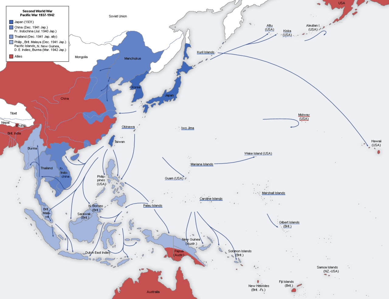
Anyone making a map of the Japanese occupation of China, or more generally of the wartime Japanese empire as a whole has a few ways they can go about it. The first and most common option is to depict the geographical expanse of Japanese control in the form of a mostly unbroken field of controlled territory as we see in Image 1 below, found in the Wikipedia entry for the empire of Japan. This approach has the advantage of simplicity and allows the viewer to consider a broader view of the scene without much clutter. The downside, however, is that it gives viewers who are less familiar with the reality of heavily contested military occupations like that of Japan in China the illusion that the war exists predominantly along the line where colors meet. It hides the reality of military occupations that are, for the most part, thin on the ground beyond a series of “points and lines” centered on larger settlements, strategically located garrisons, and the communication and transportation lines between them.
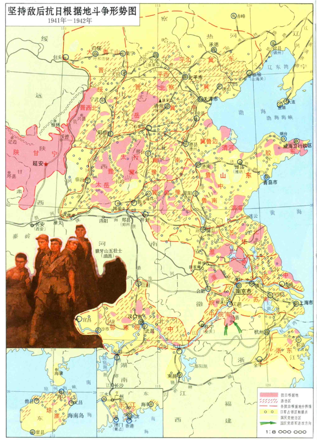
A second approach the mapmaker might take does not so much aim to directly resolve the shortcomings mentioned above as to shift the focus of attention of the viewer away from the occupation and towards the active resistance against it. The map will show the maximum expanse of the occupation in a similar manner to the first approach, but then add areas where resistance is prominent, or base areas are well established. They might also, as in the case of Image 2, taken from the wonderful atlas of the Sino-Japanese War 《中国抗日战争史地图集》(p199), have two sections indicated: one for base areas and the other showing the broader territorial zone in which the resistance carries out its operations (游击区). The resistance is the foreground, and a map of this kind goes a long way towards dispelling the illusion of continuous occupation.
A third approach often found in military histories are maps with a sequence of arrows depicting troop movements, attacks and battles, or else a series of unit markers in specific places. These kinds of documents are, of course, also the sort of thing one can often find in the archival records of the militaries of the conflict itself. While this helps illustrate a narrative sequence of events or juxtapose the relative location of opposing armies, they are somewhat less useful for providing a spatial context for the experience of an occupation.
A fourth approach to visually depicting an actively contested military occupation takes one more step towards capturing its fragmented nature. By one means or another these maps will still embrace the useful visual metaphor of the extent of an occupation by indicating an area of control or administration, but also make it incredibly clear to the viewer that there are areas beyond the secure control of anyone. An example of this approach can be found in some of the maps in the monthly reports of the Japanese North China Area Army. In Image 3, a September, 1942 map on the state of Japanese military “pacification” in northern China, three areas are designated: blue “pacified” areas (治安地区), unmarked “semi-pacified” areas (準治安地区) , and red “un-pacified” areas (未治安地区).
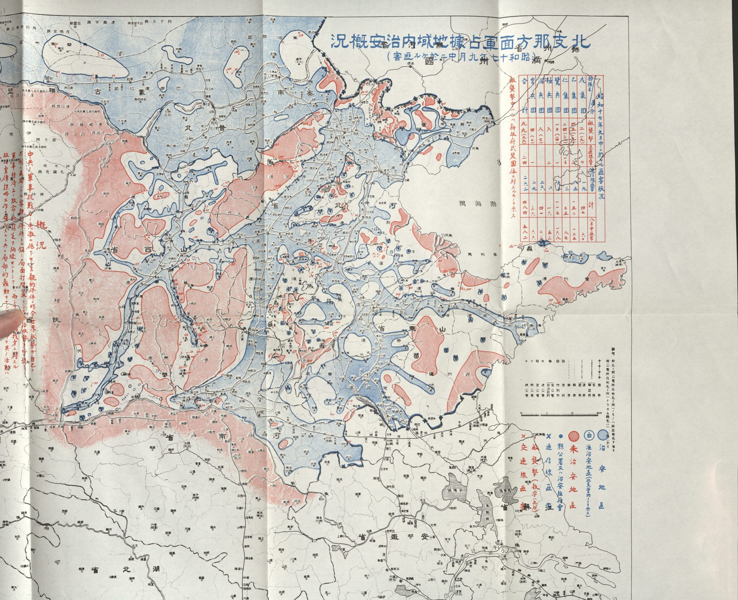
This map, which is included in an appendix to a famous 1968 Japan Defence Agency history of the war in North China, is of course a document seen from the perspective of the Japanese military at the time, but I have seen very similar mirrors of it at a more local scale in various Chinese Communist base area reports in the Shandong provincial archives. Despite the very partial nature of the occupation shown on this map, it is in fact depicting a moment of relative Japanese strength in 1942, showing the successful results of a number of counterinsurgency campaigns in North China over the preceding year or so.
The white areas on this map are optimistically described as “semi-pacified”, but preserving the unmarked open spaces help, I would argue, prepare a student of the Sino-Japanese war mentally for what they will encounter in the diaries, memoirs, and reports from the villages and countryside of many areas of wartime northern China: the agent of control in the area often amounted to, “whoever is passing through at the moment” or else, “whoever hangs about here the most.” This may be Japanese forces, their “puppet” Chinese allied forces, a particularly strong group of local bandits, some self-protection militia, a secret society militia, or resistance forces fighting under the orders or at least in the name of the Communists or Nationalists.
From the point of view of everyday life, depending on your luck, the worst place to be on this map may not necessarily have been under Japanese oppression in a blue area, or suffering the deprivations of some poorly supplied resistance base area, or even caught directly in a place where the two forces are facing off with each other at close quarters. Instead, those white spaces between were often a living nightmare, facing the unpredictable predations of the latest murderous counterinsurgency campaign of the Japanese, the raids and direct pillage of any number of other armed groups, and sometimes repeated taxation and confiscations from two or three different groups who have all told you that your village is under their control.1
To help explore the 1942 map a bit easier, I have georeferenced it and (using Claude Code), created an interactive version here:
Japanese North China Area Army Map — September 1942
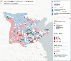
Keep in mind the map is specifically for the North China Area Army monthly report, so it doesn’t give you a depiction of areas under occupation further south (or the occupation landscapes of Japanese occupied Manchuria, or parts of Japanese allied Mongolian forces).
Ultimately, however, even this type of map, whoever puts it together, is an abstraction that cannot but help obscure further complexity. It doesn’t depict, for example, the porous and interconnected nature of occupied and unoccupied areas. This is captured well in an old 1980 chapter by Lloyd E. Eastman:
The “front” that divided Japanese-occupied from unoccupied China was largely illusory…The front was therefore highly porous, permitting a more or less steady flow of people and goods from the side of one belligerent to the other. Postal service, for example, was maintained between the two areas virtually without interruption throughout the war. All hotels in Wan-hsien, on the upper course of the Yangtze, had “travel agents” to assist persons in the Nationalist area to reach Japanese-held Hankow…”2
This is captured fairly well in a Shandong communist report on the financial burdens on village families subject to multiple taxes from multiple claimants I have written about in an older Frog in a Well post here (and here). ↩
Lloyd E. Eastman, “Facets of an Ambivalent Relationship: Smuggling, Puppets, and Atrocities during the War, 1937-1945” in Akira Iriye The Chinese and the Japanese: Essays in Political and Cultural Interactions, p275-6. My thanks to Yang Daqing for reminding me of this classic piece. ↩

Test comment
Nice,
Regarding the porous front, I have not yet been able to track this down, but apparently Chinese spies in Wuhan could send in messages about Japanese planes taking off on bombing runs by..making a phone call to the other side.